Why urban heat island effect is a problem in Fredericksburg and Planning District 16, what our study found, and how we can address it.
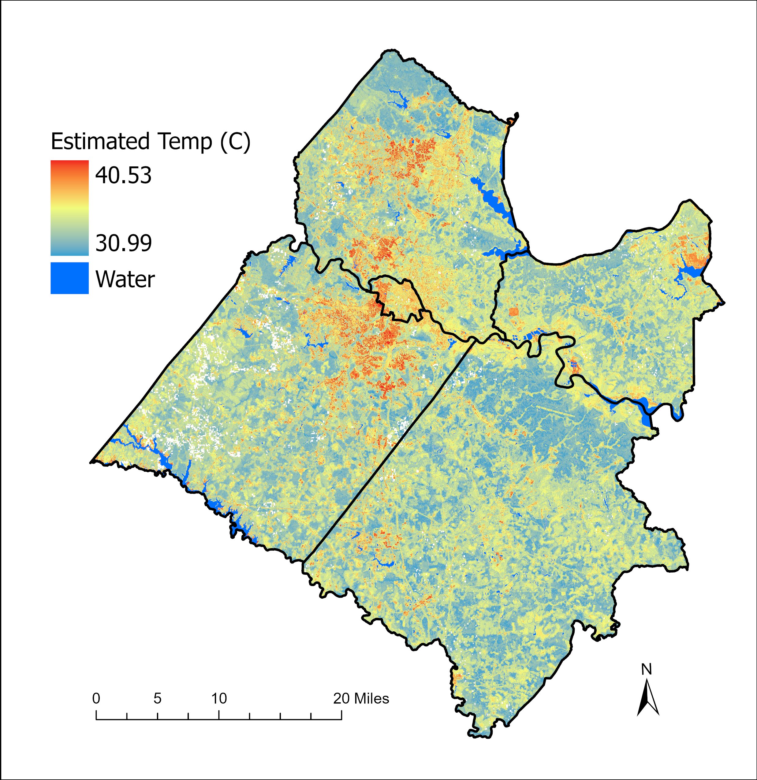
This past summer in Fredericksburg, VA we had a unique opportunity to study the temperature of our urban environment compared to the rural surroundings. Friends of the Rappahannock partnered with the George Washington Regional Commission (GWRC) to study the effect of urban heat island on communities and water resources in the Fredericksburg area.
So what is Urban Heat Island Effect?
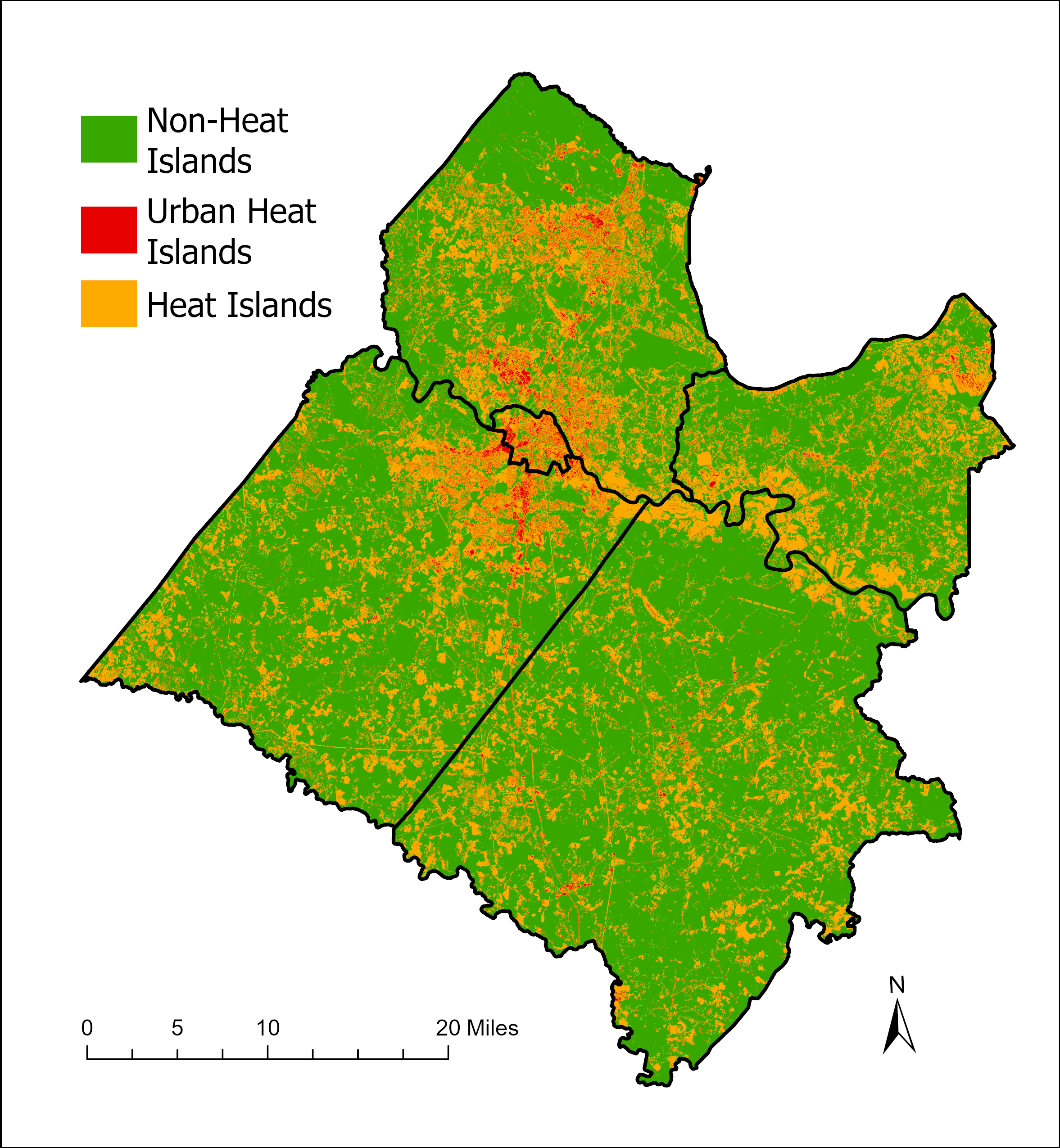
Urban Heat Island Effect is when the temperature in an area with a high concentration of buildings, asphalt, concrete, and dark materials is higher than the surrounding areas. These are surfaces that absorb and trap heat to re-emit throughout the day and into the night.
An Urban Heat Island is identified by having higher temperatures than the nearby agricultural land covers. Locations with small tree coverage and high amounts of human activities that emit heat, like cars and industrial facilities, are impacted more.
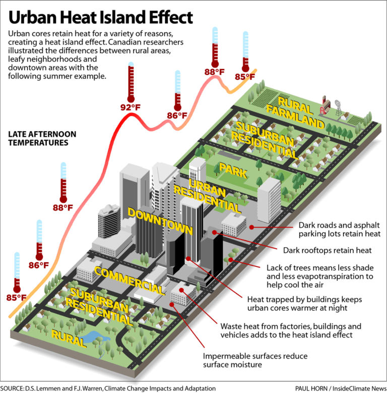
Urban heat islands vary in temperature due to different land covers in a city’s structure.
Urban Heat Island Impacts
There are various impacts of a concentrated high temperature regarding the environment and the community living in that environment.
One impact is when there are higher air temperatures, people have a higher risk of heat exposure, heat exhaustion, and heat stroke. Citizens over the age of 65 and people with asthma, other lung issues, and heart issues will be affected more.
Low-income communities are often more vulnerable to urban heat islands than surrounding areas. The lack of trees in parks, yards and along streets often reflects higher temperatures in these areas.
Another impact is after a heavy rain event, the stormwater runoff warms up before draining into the nearest body of water. Just by the runoff water from streets, neighborhoods, and rooftops warming a slight bit before retreating to the nearest body of water, we introduce thermal pollution to our environment.
This thermal pollution affects the reproduction and metabolism of species within the aquatic habitat. Thermal pollution decreases biodiversity and impacts the local food web. With warmer water temperatures, water recreational activities may have less revenue coming from fishing, swimming, kayaking, and other water sports because of poor fishing conditions and water quality.
Another impact of urban heat islands is the decreasing walkability of cities, which impacts commerce for businesses that cater to citizens who lack access to good transportation.
Citizen Science to Identify Urban Heat Islands
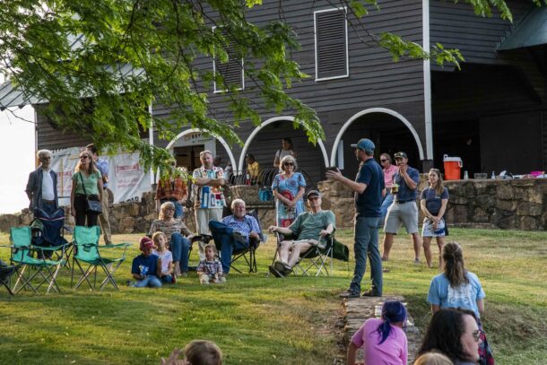
Armed with all this information, we rallied together to do our own local study. On July 10th, 2022, 37 volunteers went to 20 sites throughout the 5 municipalities within Planning District 16 (Counties of King George, Stafford, Spotsylvania, and Caroline, along with the City of Fredericksburg). These sample sites varied across different land covers. We collected 330 air temperatures total between 3 and 4 pm.
After collecting the data, we took these air temperature values along with other variables such as land cover, vegetation, elevation, and land surface temperature to predict the air temperature of the study area. The areas with an air temperature over the agricultural land’s average air temperature was a heat island. The heat islands within urban areas were urban heat islands.
Impacted Streams
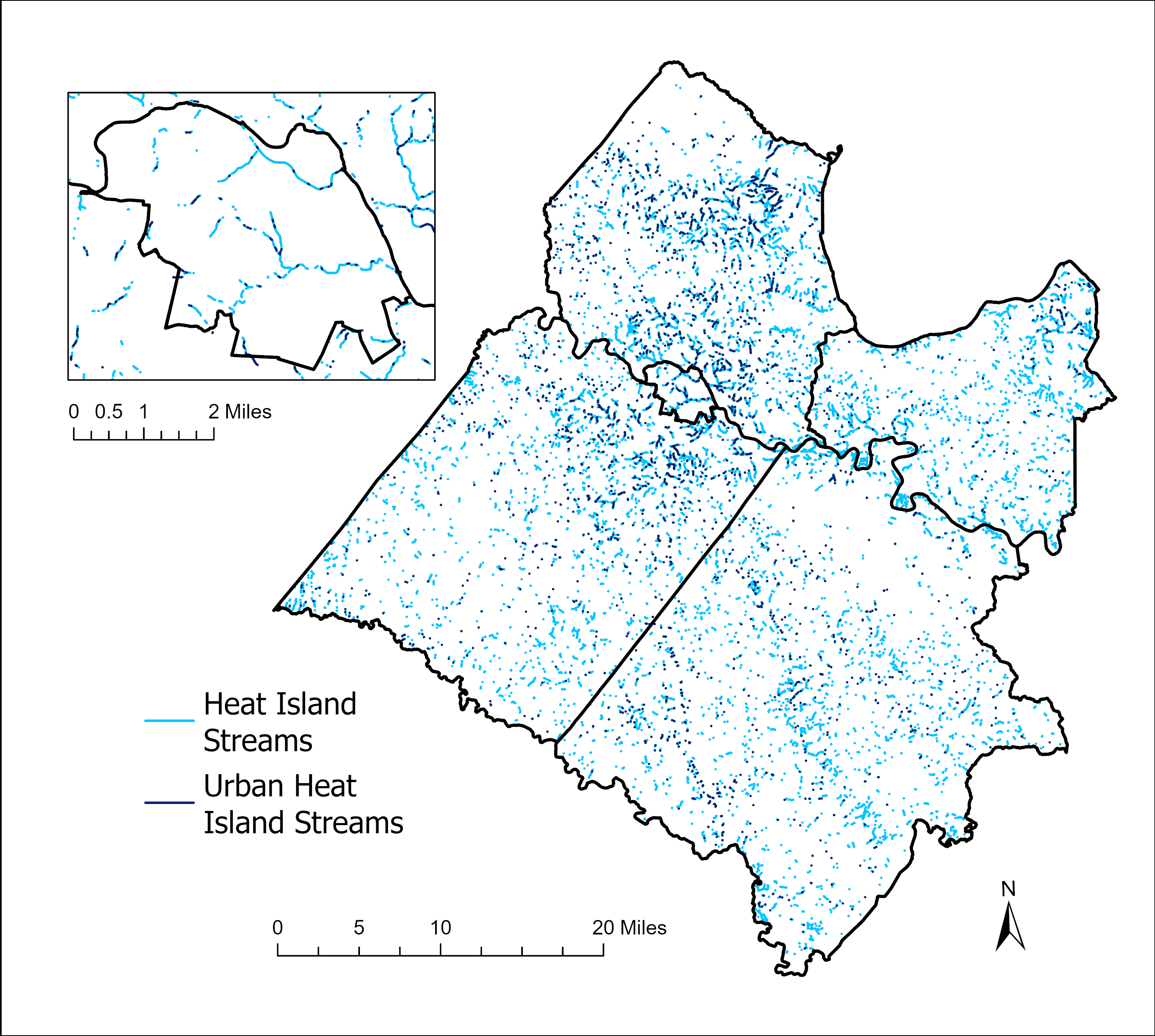
Due to the environmental impacts mentioned earlier, the temperature of the bodies of water within heat islands and urban heat islands is influenced. By overlaying a stream layer on the study area, we could find which streams were located inside a heat island or urban heat island. Around 9% of the streams were in heat islands within the planning district.
Streams within heat islands and urban heat islands with a zoom into Fredericksburg.
Solutions to Reducing Urban Heat Islands
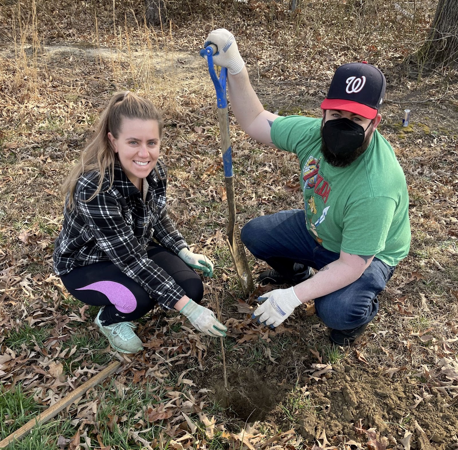
Now with our analysis and data, we can start providing solutions to reducing the heat islands in the area. Trees and other vegetative land cover within cities and other heat islands are important for providing shade and cooling down the nearby area. Last year, Friends of the Rappahannock planted over 70,000 trees in the Rappahannock River watershed alongside local organizations like Tree Fredericksburg, the George Washington Regional Commission and the Virginia Department of Forestry.
Installing green roofs will stabilize the temperature inside of the building and lowers the usage of air conditioning and central heating units. This will decrease the air pollution released into the atmosphere, which helps the air not trap as much heat. Additionally, having more reflective surfaces will help the heat not become absorbed in urban centers as much.
Decreasing impervious surfaces, land cover of impenetrable materials like asphalt, concrete, stone, and brick, and increasing vegetation are the main solutions to mitigating urban heat islands. Friends of the Rappahannock works with local governments and businesses to inform them of the importance of future actions that can be taken to mitigate and reduce the urban heat islands.
Now that we have gone through the steps to find heat islands and urban heat islands along with their solutions, we can continue this study by repeating it in the future to see how the air temperatures change with changing land cover. The hotter air temperatures could cool down with the addition of more trees within centers of impervious surfaces. Furthermore, we could look into parameters of water like temperature near these heat islands to see their relationship.
How to Get Involved
- Plant trees and other vegetation on your land/in your yard
- Participate in local tree planting events with Tree Fredericksburg and Friends of the Rappahannock
- Install green roofs
- Carpool, use public transportation, walk, or bike places to reduce air pollution
- Build with lighter-colored reflective materials
- Advocate for more forested land cover and less impervious surfaces
- Don’t forget to check out local environmental organizations to see how else you can get involved!
Published November 2022

