LIVING SHORELINES
Giving a helping hand to nature to keep our shores strong and vibrant!
What is a Living Shoreline?
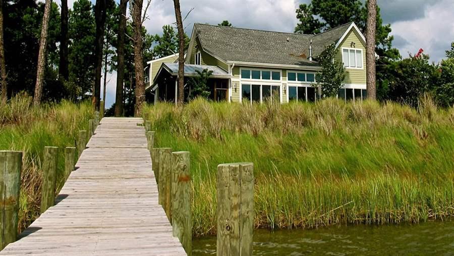
Living shorelines are nature-based approaches for shoreline protection. This means looking at what natural features exist (or used to exist) along your shoreline – like a marsh or beach – and restoring those features to your shoreline (sometimes with wave protection like breakwaters or sills made of oyster shells or stones). Living shorelines can stabilize your shoreline, improving water quality and providing habitat for fish, oysters, and other important Bay creatures.
Living Shoreline Examples Throughout Virginia & Beyond:

Why are living shorelines important?
Living shorelines offer environmental services that benefit both people and nature. These include purifying water, buffering floods, reducing erosion, storing carbon, and attracting wildlife to new habitats.
In addition, one of the leading causes of pollution to the Rappahannock River, Chesapeake Bay, and throughout the Northern Neck is sediment from eroding stream banks and shorelines. Living shorelines are the preferred shoreline stabilization method used in the Commonwealth of Virginia unless scientific evidence suggests otherwise.
On top of all this, living shorelines are visually appealing and low-maintenance green spaces, which provide focal points for people to congregate.
Initiating a Living Shoreline: Where to Begin?
Site Analysis & Erosion
Erosion is a natural process that occurs along many Chesapeake Bay shorelines, with bare soil areas, fallen trees, slumped banks, and gradual shoreline retreat being common signs. In addition, erosion rates have been on the rise in many regions, partly due to boat traffic, sea level rise, and heavier rainfall, leading to increased wave intensity.
Managing Erosion – Options to Consider: Erosion doesn’t always have to be corrected. If the rate of erosion is slow and the risk to property is low, it may be best to leave the shoreline as it is. However, if the erosion cannot be tolerated, consider using a living shoreline to combat the issue. Forests and tidal wetlands on shorelines offer natural erosion protection which can be costly to restore once removed.
Seek Expert Advice
Managing shoreline erosion is a complex subject. To ensure the best possible outcome for your project, it is advisable to seek professional guidance and expertise in design.
- Shoreline Erosion Advisory Service (SEAS) – This is a FREE resource run by the Virginia Department of Conservation and Recreation to assist private land owners and localities in Virginia with erosion problems.
- County Specific Wetlands Boards Contact Information & Virginia Marine Resources Commission Staff – The Wetlands board members and Virginia Marine Resources Commission Staff are responsible for decisions regarding the use, alteration, or development of tidal wetlands, and in some cases coastal primary dunes and beaches.
Resources & Permits Needed
Regional & General Permits Full PDF Source: https://www.jamesrivershorelines.org/uploads/2/4/1/2/24124749/resources_for_virginia_shoreline_professionals.pdf
Group 1 Permit:
Covers sand fill, fiber logs, fiber mats, shell bags, and temporary grazing protection in tidal wetlands, landward of mean low water to improve the growing conditions for wetland vegetation. Establishing oysters and ribbed mussels may be incorporated into the project design. These permits are appropriate for living shorelines comprising primarily natural materials, constructed in tidal wetlands landward of mean low water, and located in an area with relatively low fetch (less than 0.5 miles). Group 1 permits do not require public interest review, notification of adjoining landowners, or a permit fee if approved.
Group 2 Permit:
Covers a wider range of living shorelines, including those with a more hybrid design (such as sills), and can be constructed in areas with a fetch of up to 1.5 miles. Group 2 permits do not require a public interest review or a permit fee (depending on your locality) if approved. Group 2 permits do require you to notify adjoining landowners.
Joint Permit Application (JPA) is required for larger more complex projects: https://usace.contentdm.oclc.org/utils/getfile/collection/p16021coll7/id/12642
Funding Opportunities
- The Northern Neck Soil & Water Conservation District offers cost-share funding for qualifying living shoreline projects that do not exceed a maximum fetch of 1.5 miles in any shore angle direction. This program is known as the Virginia Conservation Assistance Program (VCAP). In addition, technical assistance, financial assistance, and state tax credits are offered for agricultural living shoreline projects through the Virginia Agricultural Cost Share Program.
- The Resilient Virginia Revolving Loan Fund was established to aid communities and property owners impacted by flooding. For larger community-level shoreline issues contact NNPDC staff or your local planning/zoning department staff.
- The Virginia Community Flood Preparedness Fund was established to provide community-scale support for regions and localities across Virginia to reduce the impacts of flooding, including flooding driven by climate change.
Shoreline Assessment
Living Shorelines can help protect your property from dangerous erosion all while improving water quality and aquatic habitat in the Rappahannock River and Chesapeake Bay.
For more information on our Living Shoreline program please contact us at [email protected]

